We love history, and learning about ancient civilizations is a particular favorite, so when we were asked to review
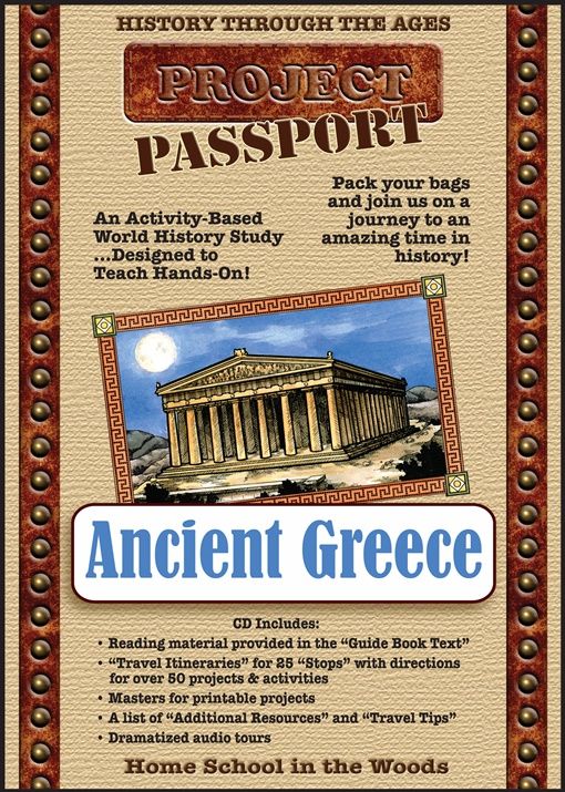
HISTORY Through the Ages Project Passport World History Study: Ancient Greece,
everybody was excited.
 Home School in the Woods
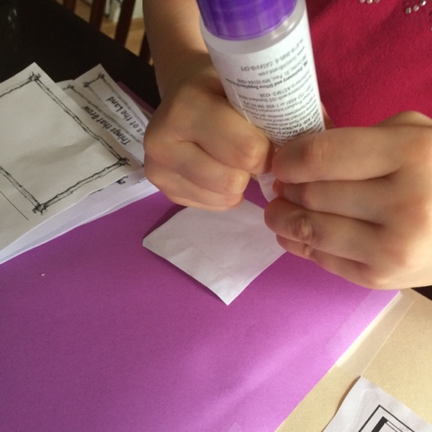
 has done a really beautiful job creating this history study pack. We were given the downloadable version, which was really easy: download, double click the file called "start" and it came right up in Firefox like a webpage: everything I need, all right there. The Project Passport is organized into 25 "stops" or lessons, and the first one is longer, because it's a lot of set-up. For the first stop, we made some "Scrapbook of Sights" binders, and printed out the included timeline to start them out. The included printables are uniformly beautiful, generous, and well-organized, so that finding them when you need them is a snap. Both Hero(10) and Dragon(6) are doing this. It's designed for kids in grades 3-8, but there is no way that Dragon is going to sit this one out, so I didn't even ask him to, even though he's only in first grade. Hero even went to the trouble of looking up Greek-style lettering for
the front of his folder, which I thought was really cool.
 |
| Binders with printed "scrapbook" covers from the Passport Project. |
Peanut(4) gets a scaled-down version for similar reasons: if we are
painting, coloring, cutting, and pasting, she
needs to be in it, doing school (ask her and see). So the boys both got
binders, according to the directions, and I sewed the timeline into a
file folder for her with my sewing machine, and let her do a map, which we glued into the
folder. Just enough for her to feel included. That ended up working out really well, because I did most of the
work on it, so it became a sample for the boys to look at. (It did cause some problems later, as she "participated" but had no where to put things; I discretely recycled a few pages later on in the project.) The maps took us a
long time, because the kids all decided that they wanted to paint them. We love maps, and the Project Passport has two maps right at the start: one a close-up of Greece, and one larger that shows most of the Mediterranean Sea. We also had a look at our globe at this point, to place Greece on a global scale. There are several additional maps later in the stops, as well. Dragon has done some map work on Egypt, as he'd also been learning about ancient Egypt recently, and it was especially fun to see him make connections, and begin to realize that the Greek stories and the Egyptian stories have places where they touch and connect.
 |
| One of the days we when worked on the maps that detail just Greece. |
The process of doing the maps and building the binder this way took a long time - we probably worked on them 2-3 times a week for 2 weeks, but I feel like it was time well spent: the boys had enough time to really
see the maps. And it was so pleasant; one week we even looked up "Ancient Greek music" on YouTube (not part of the stop) and listened to what various artists think their music might have sounded like while we worked on our maps, which lead to some really great conversation. Because the various maps all got labels on different days, the names and locations are becoming familiar: if we talk about the Aegean Sea, they know exactly what I'm talking about and can find it pretty readily on both maps. They have taken a lot of ownership of and pride in these projects, and the beautiful printables really encourage that.
 |
Working on our collection of maps - this shows both boys work, plus my sample.
Dragon's work is the binder at the top; Hero's is on the right. Mine is at the bottom. |
I had Dragon use the included labels, and glue them onto his painted map. I was a little concerned about all the labels that needed to go on the map, but with the printed labels, it's not a big deal, even though he's a little young for the project. I painted Peanut's, but she was excited to do the label gluing herself. There are actually quite a few labels, and instructions in the teacher notes about when to add them to the map. These pictures were taken after the first stop, so the maps are still pretty simple. I like that we'll add things as we talk about them, rather than doing it all at once in a barrage of strange place names without meaning. This way, they only add a place after it's been discussed in the text and has some meaning for them.
 |
| This is Dragon(6)'s detail of the Greece area, showing the map and the labels. |
 |
| This is Hero(10)'s version, with the hand-written labels. |
There was a reading -there's one for each stop- with
narrations from both boys. The readings we typically do are more narrative than factual, but that wasn't a problem. Both of them did great with a more nonfiction type of reading, and the level was great for them both. We laid some great groundwork, and some good conversations about the geography, and the whole first stop was extremely pleasant.
One feature that I especially liked from the reading was that they
discuss the traditional settlement of Noah's sons following the flood
being in ancient Greece. Having been educated in the public schools
myself, I often don't know about connections like this between Biblical
history and secular history, but the distinction between "Biblical history" and "secular history" is artificial. There is
only history; real history includes both aspects. I love it when the materials we use treat it as the one
interconnected whole that it is. One of the booklets we made for the lapbook is a family tree of Deucalion/Noah's son Hellen, and we built it to be color coded to the map of the areas that they settled, which was pretty interesting to see. I had never realized that Greece had "tribal" areas before. The booklet was fiddley to put together - well beyond what Dragon could assemble on his own, though he did get some fine motor practice in helping to cut things out, but I felt like, once I'd made it, it enhanced his understanding of what was going on, and he
is two years younger than the recommended age for the project. He thought it was pretty cool that you could make a little book like that, and was able to explain the family structure when it was finished. We came back a different day and added the various places mentioned to our other maps. Hero did his a different day, and much more independently, because he was sick
again when Dragon and I did this. These booklets will be assembled, with several others, into a lapbook later in the Project. For now, we just tucked them into the front of the binder to keep them safe.
 |
| Dragon(6) with booklet of Hellen's family and their tribal areas in Greece. |
Periodically through the project, the kids receive "postcards" from ancient figures. When I first saw these, I was pretty skeptical about their value, and almost decided to skip it. However, after the boys received the first one, from Agamemnon, they had turned on a Librivox recording of a retelling of the Trojan War, and both boys immediately recognized Agamemnon in the story, and were excited to hear what happened to the character that had sent them their first postcard. I was pleasantly surprised at how well this simple activity laid the groundwork for getting more out of the literature they were listening to. There's an option to print these with a border on the back and have the kids draw on them, but my printer hates to print double-sided, so I skipped that. So far, it's the only activity that my cranky printer has made problems for. The printables are uniformly well-done and beautiful, and all the assembly we've done so far (such as the post card rack here) has great instructions. Older kids probably would be able to do it pretty independently; my younger kids were able to do it with minimal instruction.

Another project that gets assembled early on then added to as you go along is the "Greek Weekly" newspaper. I decided that only Hero would do this section, but because he's been quite sick, he hasn't started it yet. Although it's geared for grades 3-8, there's a lot of things in the Project Passport that are easily adaptable to younger kids, but my first grader just isn't ready for this kind of activity. The instructions have some cool ideas for assembling it to look like a real newspaper, and suggest printing on fancy paper, front to back, so that you can turn the pages properly, but in the end I decided to just keep it simple: a file folder cut down a little became a divider in the Scrapbook of Sights binder, and I just hole punched the pages and put them in his book. I like that there's a place for writing in this, and I also like that the areas given on the pages are small enough to not overwhelm my reluctant writer. I think that, if you had a more enthusiastic writer or an older student, it would be a simple thing to make up a few pages for the stories to continue, as newspapers frequently say, "Story continued on B-13" in real life. There is no included printable for that, but finding lined paper, or even printable lines if you're using fancy paper, shouldn't be a difficulty at all.

One thing I would love to have seen more of is links to museums for samples of scripts and art, though they do include some line drawings of various artifacts and clothing. However, the text includes some great vocabulary that could easily become key-words for searching online collections that so many museums have generously put out there. Additionally, I wish there was more literature or Librivox (or other audiobook) recommendations that line up with the "stops" on our trip. There are a book titles mentioned in the "Additional Resources" section, but a "this story fits here" where those resources belong in the timeline would be really useful. (I think there is some of that, in later stops, but because we spent the bulk of February fighting influenza, we haven't gotten as far in the project as I had hoped, and if it's there, I haven't found it in the later materials that I've looked through so far.) We love stories: literature is so much more memorable than the textbook-style text that's included; it's personalities that stick, not places and dates, and so literature tends to impact the student far more strongly than texbooks, and it would be nice to have more recommendations. On the other hand, I feel like the activities helped build some framework for where the stories belong, both in terms of on the maps, and also in the discussion of their government, housing, and clothing, and quite a few others, which all have a place in the many included activities. There's even some recipes to try. Our regular studies include quite a bit of Greek myths and epic tales of all sorts are a favorite that my kids go back to repeatedly whether I assign them or not. The activities at the stops are adding a whole lot of depth and context to what they learn in the stories as they are exposed to them.
With 25 stops, this Project Passport is really packed, and to really do it justice, it needs to be planned a couple times a week over a longer of time, probably several months. I don't want to rush things. We learned quite a bit during the review period, and had a lovely time doing it. My kids are excited when they see Greece on the schedule, and we are all -including me- learning a whole bunch of new things.
This is one of several different Project Passport kits that Homeschool in the Woods offers, and the Review Crew members were fortunate to be able to try all of them, so if you want to know what other families thought of Ancient Greece, or any of the other Projcet Passport kits, click on the banner below to read about it.


 One cool thing about this packet is that it's very simple. Once we set it up, we just added a little bit to it a couple of times a week. There are 20 projects in all, plus instructions for assembling them into a very nice lapbook, but while that sounds huge, it doesn't feel huge, working on it. The kit that you receive from Homeschool in the Woods had materials for doing all 50 States, which is nice. When I was a kid, our family moved around, but I considered Utah to be our home. We had just moved to Wisconsin, and so when my 4th grade teacher announced that we were going to be learning about our "home state" I raised my hand and asked, "So, will I be learning about Utah? Because Wisconsin is not my home state." That was one of several times when that teacher did NOT smile at me; I had a difficult year that year. But if your family has similarly strong ties to several States, it would be a simple thing to use this Activity-Pak to learn about whichever States your interest draws you to, and at no extra cost for the additional States. In fact, because we do have a lot of family and church history that takes place in Utah, I'm considering asking the kids if they are interested in doing a second lapbook for Utah, when we have finished Wisconsin. There are several other States that our family has ties to that would be candidates for that kind of activity at some point, either in doing the whole project again, or in doing selected booklets.
 It's really easy to adapt to the various levels the kids are ready for: Peanut is primarily cutting and coloring, which is great for her fine motor skills and her need to be included when we do school. Dragon is getting his first exposure to some of the State trivia (our bird is a Robin, and our flower is a Wood Violet), and Hero is getting all that, plus he's getting practice at searching for information that he needs for this kind project: I'm having him do his own googling for most of the things, and helping him to figure out how to extract information from his search results: What are the biggest cities in the State? What was the population at the last census? Part of what I intend for him to gain from the activity is an increased ability to find this kind of information. Make-a-State's adaptivity is one of my favorite features about it.
 Activity 7, the wildlife and plants of Wisconsin booklet (pictured left), is supposed to be printed front to back. My printer doesn't do that very well, and the instructions for how to do it are somewhat lacking on how the alignment ought to be, so putting that particular book together was something of a headache. We ended up printing two pages and gluing them back to front, and then assembling the booklet from there, rather than printing it doublesided. That being said, that booklet ended up being one of my favorites as the kids filled it out. I had the boys select and draw plants and animals from Wisconsin, and it was fun to see them draw on the things they have learned from our time doing nature study to fill this out. So far, this has been the only booklet that gave us trouble in assembly, and I've worked on 13 of the 20 included projects. All the rest of the instructions have been clear and easy to follow, and even the four year old can do a large amount of the cutting and assembly successfully.
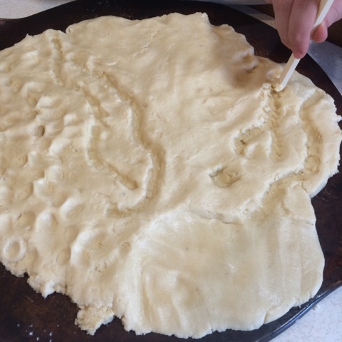
 Putting our own rivers on the State is challenging; I'm glad we don't have very many major rivers, and no mountains to try to depict! We ended up with some geographically suspect city placement, even with coaching on how to go about locating cities relative to several points on the border, but I feel like it was a good exercise anyway, and that even with some inaccuracy there's been good learning that went on here. It's also showed me that in our art instruction we need to talk about how to measure and look at some tricks to help my oldest be more aware of proportion. This is good information, and I really handn't suspected it before, so I'm glad that this project is set up the way that it is.


